de Vaugondy Robert (1688-1766)
de Vaugondy Robert (1688-1766)
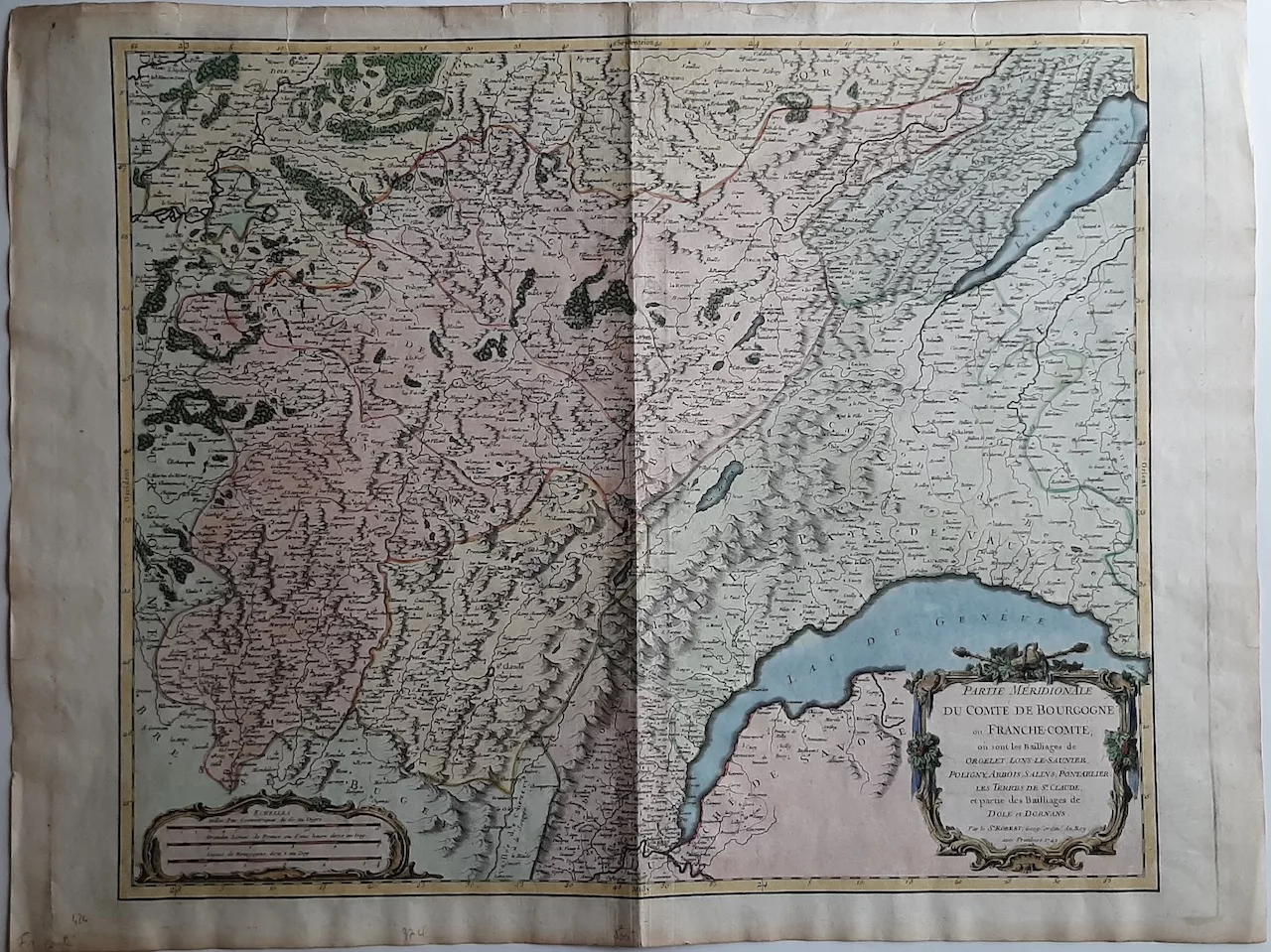
Southern part of the County of Burgundy or Franche-Comté, 1749
de Vaugondy Robert Bourgogne – Enhanced etching and burin
250,00 €
Description
de Vaugondy Robert (1688-1766)
Southern part of the County of Burgundy or Franche-Comté, 1749
de Vaugondy Robert Bourgogne – Enhanced etching and burin
Fine proof on laid paper, enhanced with fresh period colors. Color geography map by Gilles Robert de Vaugondy, known as Robert de Vaugondy (1688-1766), French geographer and cartographer.
de Vaugondy Robert Bourgogne – Carte en couleurs de la Partie Méridionale du Comté de Bourgogne ou Franche-Comté, où sont les Bailliages de ORGELET LONS-LE-SAUNIER, POLIGNY, ARBOIS, SALINS, PONTARLIER, Les Terres de St-Claude et partie des Bailliages de DOLE et DORNANS.par le Sieur ROBERT Géographe ordinaire du Roy, 1749.
Sheet dimensions (with center fold, usual for a map of this size): H. 513 mm x W. 680 mm – Bowl dimensions: H. 495 mm x W. 626 mm
Condition: small tears in upper margin, restored.
Reviews
There are no reviews yet.